This research project investigated the Tabula Peutingeriana from the perspective of the “common sense geography”, theory jointly developed by Topoi research group (C-5) Common Sense Geography. With regard to the significance of this source it is surprising that an academic commentary had not been provided yet.
Research
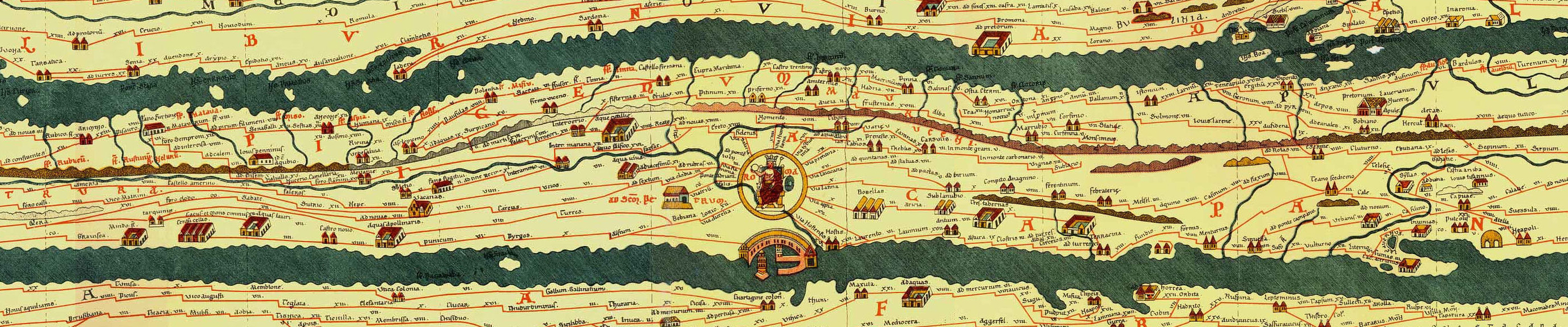
Detail Tabula Peutingeriana (click to enlarge)
The Tabula Peutingeriana is one of the most impressive ancient testimonies that has survived as a medieval reproduction. Being listed as part of the UNESCO World Heritage only serves to underline its significance. From Iberia to India, nearly the whole of the known “ancient world” is depicted on a parchment roll of about seven meters in length, measuring only 36 cm high.
Results
According to the three goals set for this project, all have been accomplished. Primarily, a new facsimile reproduction of the Tabula Peutingeriana was published (“Tabula Peutingeriana. Die einzige Weltkarte aus der Antike”, Darmstadt 2016/2). Secondly, the contents of the Tabula were being analysed. Thirdly, the conference “Die Tabula Peutingeriana und die antike Kartographie” was organized, producing a fruitful debate on the Tabula (further information on H/Soz/Kult) as well as the international Topoi workshop “Kartographie in der Antike und in den Kulturen des Vorderen Orients” to discuss the broader field of ancient cartography.
The project worked in close cooperation with research project (B-1-6) Die bildliche Darstellung von Raum in der Tabula Peutingeriana: Aneignung durch Kartographie?